the longshore current is simply the lateral component of wave action hitting a beach at an angle. It runs down the length of the beach and redeposits material long the coast.
Beach drift is the final action of the water running up the beach and then drawing back, but again in this case it happens at an angle to the beach. Hence it creates a zigzag action moving down the beach. It is responsible for the breaking up of small rocks and shell to make finer and finer sand.
Ocean waves end up sorting the sediment form coarse to fine with the heaviest material near the shore and the finer being transported further and further outward. Beaches made up of rocks and pebbles tend to have a higher gradient than those made up of sand. This is because it takes more energy to move the pebbles up on the beach. The return energy is simply gravity, and thus the pebbles must reach more slope before gravity can return them.
Besides erosion, coastal areas can be built up by deposits from the longshore currents and other water movements parallel to the shore. Deltas are one such area, material is deposited from large rivers faster than the wave action can remove it.
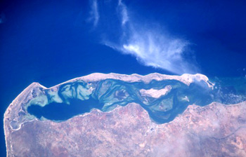
Spits are hooks of land formed by repositioning beach sand along and slightly outward from the coast.
Barrier islands are simply large beach ridges. These tend to be dune deposits that are near sea level and extend parallel to shore but are often separated from the mainland by water (a lagoon). Where sand is abundant and restored regularly (i.e.. near deltas) the islands can grow or shrink in a season and often change shape based on the weather.
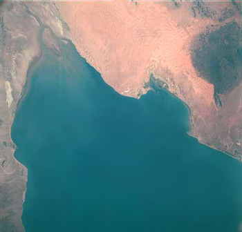
Delta in Mexico - Pinacate

Spit of land - Bekistan
Barrier Island - Angola
link to NASA image database
Reefs are built up of coral and exist at or near the equator or tropical climates, and are in shallow water.
1.) fringing reef: Closely borders or is attached to an island. Typically no lagoon.
2.) barrier reef: separated from the island by a lagoon or surrounding an island with a circular lagoon. May also lie further out from the edge of a continent.
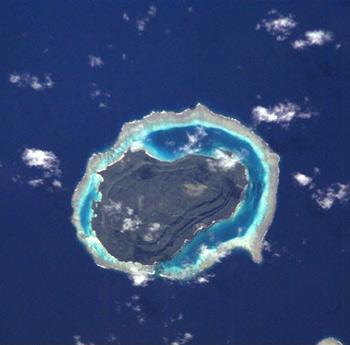
3.) atoll: A reef, usually circular enclosing a lagoon, but with no island. the island was usually a volcano that has sunk over time and no longer is higher than sea level. Usually a deep sea phenomena.
Island or fringe reef - Tuvutha Island

Example of atoll - palmerston atoll
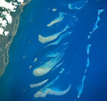
Portion of Great Barrier Reff Austrailia
link to NASA image database
Coast lines are often featured by their placement with regard to tectonic plates. those that are near large mobile plates (the pacific rim for instance) is often boarded by uplift and faulted marine terraces.
The same latitude on the Atlantic side is a far more gradual drop off and made up of old shoreline features. They owe their features to repeated glaciation and changing ocean levels.
Nearly all of the coast lines have experienced submergence since we are near the hot side of an ice age. There is more water in the ocean now than during the last ice age, and hence much of that (ice age) shoreline is now submerged.
| NEXT | TOC | PREV |